 |
 |
|
||||||

About DIGA
Program Overview
Research at SMU
Testimonials by Grads
Alumni Connections

|
About DIGA : Applicable Fields
The integration of data intelligence and geoanalytics is ideal for a wide range of data-rich fields, such as public health analytics, natural resource management, business applications, urban planning, public safety, public policy, political science, demographics, and government applications. In learning how to couple GIS technology with growing data intelligence capabilities, graduates will be more versatile in integrating technology and data science platforms, addressing issues, and solving real-world problems to generate more informed perspectives in decision making. Below are a few examples of fields using data and geoanalytics: Policy Administration/Government/Criminal Justice: State and local governments and law enforcement agencies are continually pressed to become more efficient. As a result, geographic information systems are readily used to access relevant data and manage large databases with some geographic link, such as zip codes, zoning, and parcels. Questions these users might use geospatial data to answer include:
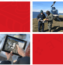
Natural Resource Management: As the world’s population continues to grow, natural resource managers need to be cognizant of new technologies that assist in managing resources. There are a vast array of tools resource managers can utilize to inform their decision making process. :
Homeland Security/Emergency Management: Natural disasters, smart population growth, world resource management, epidemic disease management, traffic control, and terrorism control all depend on questions of geography. Examples include:
Business Administration: Increasingly, businesses are compiling extensive databases with considerable geographic information. Innovative businesses are using technology to harvest this data to analyze, predict, and manage their resources, becoming more efficient in their market. From international corporations to entrepreneurial startups, companies are asking questions such as:
You can find information about how GIS is used in many more industries here: http://www.esri.com/industries.html . “The application of GIS is limited only by the imagination of those who use it.”
|